On Aug 18, an automated UN-European Commission warning network flagged a tropical depression east of the Northern Mariana Islands. Four days later it was Typhoon Saudel-26, a Category 4 storm with 213 km/h winds and 13.1 million people in its path.
Saudel hit Zhejiang province on Aug 28, then did something less common: it reformed. After weakening inland, the storm re-emerged over the South China Sea and regained typhoon strength, heading for the Taiwan Strait as of Sept 3.
Why it matters
Thirteen million people in Japan, China, and the Northern Mariana Islands got ten days' warning that a Category 4 typhoon was coming.
Questions about this story
Free account needed to ask — your question is kept and asked for you right after sign-up. Answers are public.
No questions yet — be the first to ask.
Key Indicators
213 km/h
Maximum sustained wind speed
Peak intensity on Aug 22, Category 4 on the Saffir-Simpson scale, per IBTrACS. GDACS's summary lists 231 km/h as the overall maximum.
13.1 million
Population exposed to Category 1+ winds
GDACS RSS alert estimate at issuance on Aug 18; a later GDACS report page lists 1.3 million for the refined track.
4 days
Tropical depression to Category 4
Rapid intensification from Aug 18 to Aug 22.
950 mb
Lowest central pressure in IBTrACS track
IBTrACS operational track lists 950 mb on Aug 23; JMA reported 940 hPa on Aug 25.
2
China landfalls on Aug 28
Saudel came ashore at Yuhuan at 08:05 local time and Wenzhou at 09:10.
3rd
Typhoon to hit Kanmen, Yuhuan in 2026
Bavi and Dolphin also made landfall at the same Zhejiang town; Saudel was the third in two months.
Sept 1
Expected date of redevelopment
JMA forecast the remnant depression to regain typhoon strength by the morning of Sept 1 over the South China Sea.
45,000
People in tropical-storm winds near Marianas
First populated area exposed Aug 21-22, per GDACS track data.
16 events
Latest: September 3rd, 2026 · 1 week ago
Showing 8 of 16
JK to step
Tap a bar to jump to that date
September 2026
Revived Saudel near Taiwan Strait
LatestWarning
The storm was forecast to reach the area near the Taiwan Strait in the early hours of Sept 3, with Taiwan under a large-scale low-pressure system and local heavy rain risk.
Redevelopment expected over South China Sea
Redevelopment
The revived Saudel was expected to reach typhoon strength by the morning of Sept 1 and track northeast across the South China Sea toward the Taiwan Strait.
August 2026
JMA tracks depression, expects redevelopment
Forecast
JMA placed the remnant depression at 20.4N, 110.2E over southern China and forecast it to redevelop into a typhoon by Sept 1, keeping the name Saudel rather than a new storm number.
CMA drops typhoon designation
Weakening
After weakening to a tropical depression inland, the storm was no longer classified as a typhoon. The China Meteorological Administration discontinued its designation at 17:00.
Saudel hits Zhejiang, weakens inland
Dissipation
Saudel made landfall near Yuhuan at 08:05 local time and near Wenzhou at 09:10, then weakened to a tropical depression. The remnants later redeveloped over the South China Sea.
Double landfall in Zhejiang
Landfall
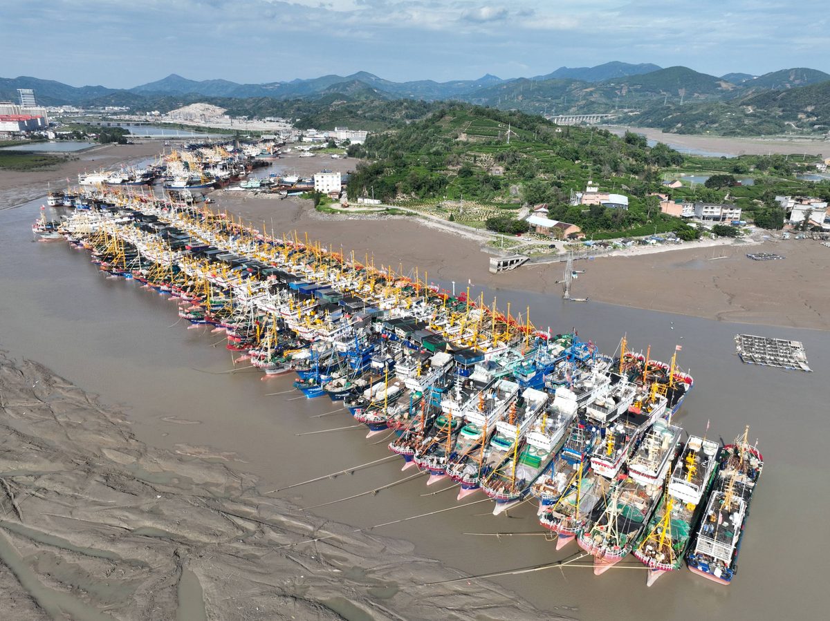
Saudel came ashore at Kanmen in Yuhuan, Zhejiang, at 08:05 local time with 35 m/s winds, then made a second landfall near Wenzhou at 09:10. It was the third typhoon to hit Kanmen in 2026.
Fujian raises emergency response to Level II
Response
China's Fujian province activated its second-highest typhoon emergency level ahead of landfall, with a Level IV flood-control response in place.
RSMC forecasts China landfall
Forecast
Saudel at 28.6N, 125.3E with 75-knot winds; China landfall forecast within 36 hours.
Saudel pounds Okinawa and Amami
Impact
Saudel crossed Okinoerabu Island around midnight, then swept past Okinawa and Amami. It injured two people, cut power, and forced about 150 flight cancellations at Naha airport.
Okinawa in the crosshairs
Warning
Saudel 335 miles east of Okinawa, 115 mph, forecast to pass near as Category 2.
Saudel holds Category 4 strength
Intensification
GDACS listed 231 km/h as the storm's overall maximum wind speed; the JTWC operational track showed 222 km/h on Aug 23.
Rapid intensification to Category 4
Peak intensity
Saudel peaks at 213 km/h with 950 mb central pressure over open Pacific.
Saudel becomes a typhoon
Intensification
Storm jumps Category 1 to 2 in 12 hours; 45,000 islanders in tropical-storm winds.
Saudel nears typhoon strength
Development
Winds reach 93 km/h as the storm moves west-northwest toward the Marianas.
Storm strengthens, named Saudel
Development
RSMC Tokyo upgrades the system to tropical storm Saudel with 65 km/h winds.
GDACS issues orange alert as depression forms
Alert
Tropical depression forms east of the Northern Marianas; GDACS estimates 13.1 million exposed.
Scenarios
1
Saudel becomes a major typhoon and reaches mainland China
This was the warning scenario behind the orange alert. The storm follows the subtropical high's southern edge across the Pacific, intensifies over open water, passes near Okinawa, and reaches the Chinese mainland. It verified: Saudel peaked at Category 4 on Aug 22, passed Okinawa, and RSMC Tokyo forecast China landfall within 36 hours on Aug 26.
2
Saudel recurves northeast and spares populated areas
Possible
Resolves by Sep 1, 2026
Discussed by: JTWC and RSMC Tokyo forecast discussions; recurvature is the standard alternative to a westward track
A mid-latitude trough could steer Saudel northeast before it reached Japan, pushing the storm over open ocean. That path would have cut the exposed population from millions to near zero. It did not verify: the storm continued west-northwest, passing Okinawa and heading for China.
3
Saudel weakens before landfall, shrinking the exposed population
Possible
Resolves by Sep 1, 2026
Discussed by: RSMC Tokyo reasoning #34, which cited dry air around the system and increasing wind shear
Dry air and shear could erode the storm before it reached populated areas, keeping peak winds below major-typhoon strength. Saudel did weaken from Category 4 to 75 knots by Aug 26, but it stayed a typhoon until the approach to China, so this scenario did not verify.
4
Revived Saudel reaches Taiwan Strait or makes a second landfall
Likely
Resolves by Sep 10, 2026
Discussed by: JMA forecast via Weathernews (Aug 31)
JMA expected the redeveloped Saudel to move northeast across the South China Sea, reaching the northern South China Sea on Sept 2 and the area near the Taiwan Strait in the early hours of Sept 3. A second landfall on the Chinese coast or a close pass by Taiwan would extend the storm's impact beyond its first landfall.
Historical Context
3 moments from history that rhyme with this story — and how they unfolded.
1 of 3
July-August 2015
Typhoon Soudelor (2015)
Soudelor, a Category 5 super typhoon, crossed the Northern Mariana Islands, Taiwan, and eastern China in August 2015, leaving dozens dead and knocking out power on Saipan for weeks.
Then
Saipan lost power and water for weeks; Taiwan and China's Fujian province suffered heavy flooding and landslides.
Now
The storm set the benchmark for Northern Marianas typhoon damage before Yutu surpassed it three years later.
Why this matters now
Soudelor tracked the same corridor as Saudel-26: Northern Marianas to Taiwan to eastern China.
2 of 3
September 2018
Typhoon Mangkhut (2018)
Mangkhut, a Category 5 super typhoon, crossed the northern Philippines and then struck Guangdong, China. More than 130 people died, most in the Philippines, and Guangdong evacuated millions before landfall.
Then
The Philippines took the heaviest casualties; China's mass evacuations kept its toll comparatively low.
Now
Mangkhut remains a reference point for how preparation shapes typhoon death tolls in the western Pacific.
Why this matters now
It shows what a strong Saudel-26 could have meant for mainland China, where GDACS counted most of the 13.1 million exposed people.
3 of 3
October 2018
Super Typhoon Yutu (2018)
Yutu, the strongest storm on record to hit the Northern Mariana Islands, struck Saipan and Tinian with 290 km/h winds, damaging most homes on the islands and leaving residents without power for months.
Then
The US Federal Emergency Management Agency (FEMA) mounted a major relief operation; rebuilding took years.
Now
Yutu became the benchmark for Marianas typhoon disasters and a test case for Pacific island resilience.
Why this matters now
Saudel-26 formed in the same waters east of the Marianas, briefly exposing 45,000 island residents to tropical-storm winds before turning toward Japan and China.