


Pull to refresh
Logo
M6.9 earthquake strikes near Pematangsiantar, Indonesia

M6.9 earthquake strikes near Pematangsiantar, Indonesia

Built World

Deep M6.9 quake shakes North Sumatra; no tsunami, low damage expected

August 22nd, 2026: Samosir reports eight small quakes overnight

Overview

Updated Sep 2

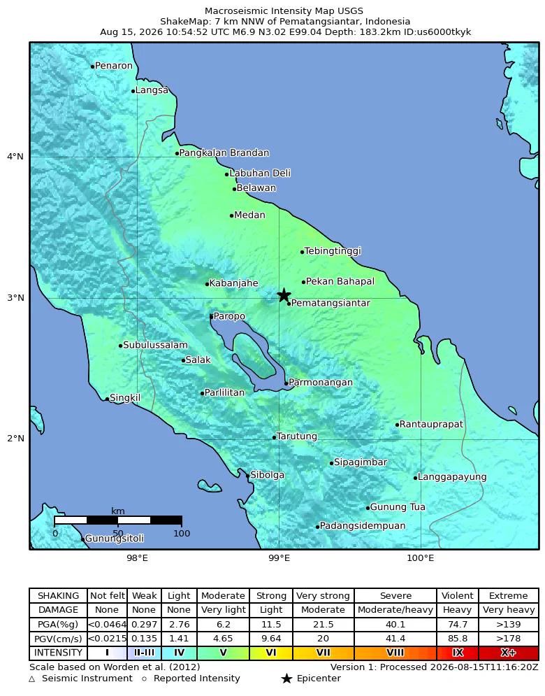
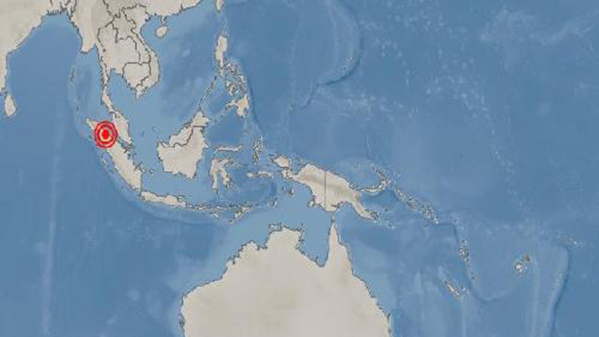
On Aug 15, 2026, at 17:54 local time, a magnitude 6.9 earthquake struck under North Sumatra, 9 km northwest of Pematangsiantar. The quake was about 175 km deep, so it shook a vast area but caused only light damage.

The quake is part of the same subduction zone that produced the 2004 Indian Ocean tsunami, but its depth and inland location made a tsunami very unlikely. Indonesia's BMKG confirmed that within hours; as of Aug 22, only small aftershocks had been recorded.

Why it matters

Depth decided the outcome: a 6.9 quake that could have been catastrophic caused only light damage.

Questions about this story

Free account needed to ask — your question is kept and asked for you right after sign-up. Answers are public.

No questions yet — be the first to ask.

Key Indicators

6.9
Magnitude
Struck 9 km WNW of Pematangsiantar at 10:54 UTC on Aug 15.
175 km
Hypocenter depth
USGS-reported depth; EMSC reported 166 km, other agencies up to 183 km.
16 million
People exposed to shaking
Estimated population within MMI level II or higher, per USGS.
V-VI
Maximum Modified Mercalli intensity
Strong shaking with very light damage reported in parts of North Sumatra.

Voices

Curated perspectives — historical figures and your fellow readers.

Ever wondered what historical figures would say about today's headlines?

Sign up to generate historical perspectives on this story.

Organizations Involved

Timeline

5 events Latest: August 22nd, 2026 · 3 weeks ago
Tap a bar to jump to that date
  1. Samosir reports eight small quakes overnight

    Latest Aftershock activity

    Eight small earthquakes, the largest magnitude 2.7, shook Samosir regency while residents slept. The cluster continued elevated seismic activity in the region.

  2. M2.7 aftershock recorded northwest of mainshock

    Aftershock

    A magnitude 2.7 aftershock occurred about 30 km northwest of the mainshock, one day after the main event.

  3. M6.9 earthquake strikes near Pematangsiantar

    Main event

    A magnitude 6.9 earthquake hit 9 km northwest of Pematangsiantar at 175 km depth. Shaking reached intensity V-VI and was felt across Sumatra, Malaysia and Thailand.

  4. BMKG confirms no tsunami threat

    Official assessment

    Indonesia's geophysical agency analyzed the quake as an oblique normal fault and said modeling showed no tsunami. It recorded intensity V in several North Sumatra towns.

  5. Foreshock recorded south of the epicenter

    Precursor

    A magnitude 2.7 earthquake occurred about 79 km south of the future mainshock, three days before the M6.9 event.

Scenarios

1

Aftershock sequence fades, no larger quake

Likely Resolves by End of 2026

Discussed by: USGS PAGER and earthquakeslist.org analysis

The mainshock released stress at depth. The two recorded aftershocks are both magnitude 2.7, far below the mainshock. This pattern, plus the green PAGER alert, fits a decaying sequence.

2

Stress transfer triggers larger Sumatran fault earthquake

Unlikely Resolves by Aug 15, 2027

Discussed by: earthquakeslist.org, citing USGS base rates

The deep rupture happened inside the subducted slab beneath the Sumatran fault system. Stress transfer to the shallower fault is possible, but USGS base rates put the chance of a larger follow-up at roughly 6%.

3

Official damage surveys confirm low impact

Likely Resolves by Oct 31, 2026

Discussed by: USGS PAGER green alert and BNPB situation reports

USGS's PAGER system gave a green alert, estimating a 90% probability of zero to one fatality and under $1 million in damage. Indonesia's disaster agency will publish the official tally. If reports match the estimate, the event will close as high-magnitude but low-impact.

Historical Context

2 moments from history that rhyme with this story — and how they unfolded.

December 2004

2004 Indian Ocean earthquake and tsunami

A magnitude 9.1 earthquake ruptured the Sunda megathrust off Sumatra's west coast at about 30 km depth. The seafloor rupture sent tsunami waves up to 30 meters high across 14 countries.

Then

Nearly 230,000 people died, most in Indonesia's Aceh province.

Now

The disaster spurred the Indian Ocean Tsunami Warning System and Indonesia's InaTEWS.

Why this matters now

The 2026 quake is in the same subduction zone but 175 km deep and under land, so BMKG ruled out a tsunami within hours.

September 2009

2009 Sumatra earthquake

A magnitude 7.6 quake struck at about 80 km depth off Padang, West Sumatra. More than 1,100 people died as buildings collapsed in the coastal city.

Then

Tens of thousands of buildings were damaged, and Padang's recovery took years.

Now

Sumatran cities strengthened building codes, though enforcement remains uneven.

Why this matters now

The 2026 quake was smaller and deeper, which is why damage is expected to be far lighter despite the similar setting.

Sources

(8)