

Pull to refresh
Logo
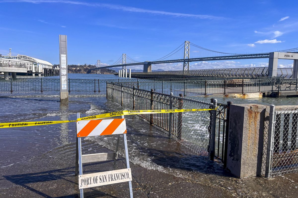
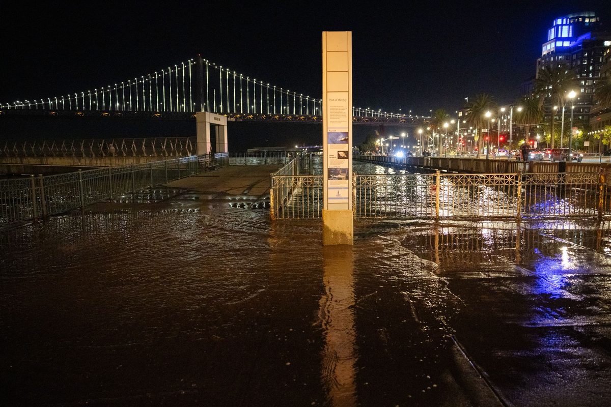
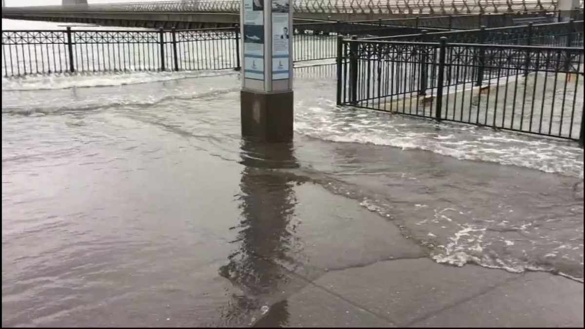
San Francisco Embarcadero floods as El Niño tides peak 2 feet above normal

San Francisco Embarcadero floods as El Niño tides peak 2 feet above normal

Built World San Francisco, CA local

Record tides hit Los Angeles and San Francisco, and flood advisories ran through the weekend along the state's coast

Overview

Updated 6 days ago

Coastal flood advisories across the Bay Area ran through the weekend after water levels climbed to 2.2 feet above normal on Oct. 29, breaking October and November records. San Francisco pre-staged sandbags, pumps and generators. The tides threatened Muni service at two low-lying spots: the Cesar Chavez and Illinois streets station near Islais Creek and the Embarcadero tunnel.

The National Weather Service extended its advisory for bayshore areas around San Francisco, San Pablo and Monterey bays through Nov. 1. A separate advisory for the North Bay and San Francisco Peninsula coast ran through Saturday evening. Southern California also saw record water levels, and Huntington Beach declared a local emergency.

Why it matters

If this El Niño delivers the storms forecasters predict, Bay Area waterfronts face repeated flooding and hundreds of millions in damage this winter.

Last Monday's email for San Francisco, CA

Sent Nov 9. It carried:

Get next Monday's: one short email a week. Free. Unsubscribe in one click.

Questions about this story

Free account needed to ask — your question is kept and asked for you right after sign-up. Answers are public.

No questions yet — be the first to ask.

Key Indicators

2.2 ft
Record high-tide reading
Water levels on Oct. 29 ran 2.2 feet above normal, surpassing October and November records, per the S.F. Chronicle.
2.7 ft
Los Angeles inundation
Preliminary all-time record water depth where water usually isn't, reached Tuesday, Oct. 27, per the National Weather Service as reported by the NYT.
Sun., Nov. 1
Bayshore advisory end
The NWS extended coastal flood advisories around San Francisco, San Pablo and Monterey bays through Nov. 1.

Voices

Curated perspectives — historical figures and your fellow readers.

Sign up to generate historical perspectives on this story.

People Involved

Organizations Involved

Timeline

12 events Latest: October 30th, 2026 · 1 week ago Showing 8 of 12
Tap a bar to jump to that date
  1. San Francisco pre-stages flood equipment

    Latest Government action

    SFMTA and city crews readied sandbags, sump pumps and generators, with priority on protecting Muni subway service at the Cesar Chavez and Illinois station and the Embarcadero tunnel.

  2. Bay Area flood advisories extended through weekend

    Government action

    The National Weather Service extended coastal flood advisories for San Francisco, San Pablo and Monterey bays through Nov. 1. A separate advisory for the North Bay and San Francisco Peninsula coast ran through Saturday evening.

  3. Huntington Beach declares local emergency

    Government action

    Huntington Beach declared a local emergency as record tides flooded the Southern California coast.

  4. Water levels break October and November records

    Measurement

    San Francisco Bay water levels reached 2.2 feet above normal on Thursday, surpassing records for October and November, the National Weather Service said. The agency extended coastal flood advisories through the weekend.

  5. Bay Area coastal flood advisory extended through Friday

    Government action

    The National Weather Service extended its coastal flood advisory for bayshore areas of San Francisco, San Pablo and Monterey bays, and low-lying Pacific Coast areas, through Friday, Oct. 30.

  6. City of Martinez limits shoreline access

    Government action

    Martinez closed parts of its shoreline during the high tides, with more closures set for Nov. 25, Dec. 23-24 and January dates.

  7. Southern California flood warnings downgraded

    Government action

    Orange and San Diego counties moved from a more severe flood warning to a coastal advisory through Friday afternoon. Tides were expected to approach 8 feet Thursday morning.

  8. Embarcadero floods as tides peak 2.1 feet above normal

    Flooding event

    Seawater closed parts of the Embarcadero as tides peaked 2.1 feet above normal. The NWS issued a coastal flood advisory for low-lying Bay Area regions, warning of more flooding along bayshore Marin County.

  9. Los Angeles sets preliminary inundation record

    Measurement

    Los Angeles reached a preliminary all-time record of 2.7 feet of inundation on Tuesday. San Francisco's 2 feet did not beat its 2.82-foot record from January.

  10. Sausalito roads and Highway 101 off-ramp closed

    Flooding event

    Several Sausalito streets and an off-ramp from Highway 101 closed for much of the day as water inundated low-lying areas near the waterfront.

  11. Los Angeles Harbor records highest tide ever

    Measurement

    Tide gauges along the California coast set records on Monday, with Los Angeles Harbor's reading its highest ever. San Francisco recorded what was then its highest October tide, per the National Weather Service; a higher reading came Thursday.

  12. San Francisco declares local emergency

    Government action

    City officials declared a local emergency in anticipation of heavy rain and flooding from the coming El Niño.

Scenarios

1

Historic El Niño floods Bay Area waterfronts through spring

Likely Resolves by Apr 30, 2027

Discussed by: National Weather Service and city and port officials cited by KQED

Forecasters expect the coming El Niño to be historic, with torrential downpours, elevated sea levels, severe thunderstorms and isolated tornadoes. If that verifies, the Embarcadero and bayshore Marin County see repeated closures, and flood damage could run into the hundreds of millions, as it did in 1997-98.

2

El Niño weakens; Bay Area escapes major flooding

Unlikely Resolves by Apr 30, 2027

Discussed by: Forecast uncertainty noted in NWS daily discussions

El Niño forecasts can shift. If the event weakens or tracks elsewhere, the region deals with a few high-tide days but no repeated emergency flooding, and the Oct. 27 closures stand as the season's worst.

3

Port installs permanent flood barriers on the Embarcadero

Possible Resolves by End of 2027

Discussed by: City officials describing the port's prepared temporary barriers

Repeated flooding through winter could push the city to fund permanent seawall or barrier upgrades along the Embarcadero, turning the current seasonal response into long-term infrastructure work.

4

Muni subway floods and disrupts service

Possible Resolves by Q1 2027

Discussed by: SFMTA acting chief infrastructure officer John Becker

SFMTA says the Cesar Chavez and Illinois streets station near Islais Creek and the Embarcadero tunnel are the two spots most likely to flood. A high tide that overtops either could shut subway service.

Historical Context

One moment from history that rhymes with this story — and how it unfolded.

February 1998

1997-98 El Niño flooding in the Bay Area

In the first week of February 1998, high winds and heavy rains combined with abnormally high tides across the San Francisco Bay region. Whitecaps up to 6 feet high splashed over the Embarcadero for the first time in recent memory, U.S. Highway 101 north of the Golden Gate Bridge flooded under 4 feet of water, and hundreds of people fled low-lying homes. At Fort Point, an early-morning tide measured 5 feet above mean sea level, about 2 feet higher than gravitational forces alone would produce.

Then

The storms caused hundreds of millions of dollars in flood and storm damage across the Bay Area in that winter season.

Now

U.S. Geological Survey analysis of the Fort Point sea-level record traced the record highs to the 1997-98 El Niño, establishing the mechanism scientists now use to forecast such events.

Why this matters now

The same El Niño mechanism that drove the 1998 flooding is now forecast again, and the Embarcadero is flooding once more — but this time the port has an established response playbook in place.

Sources

(11)