
Pull to refresh
Logo
US finalizes Colorado River plan forcing steep water cuts on three states

US finalizes Colorado River plan forcing steep water cuts on three states

Rule Changes

Arizona, California and Nevada will give up about 1.25 million acre-feet a year as Lake Mead and Lake Powell sit near record lows

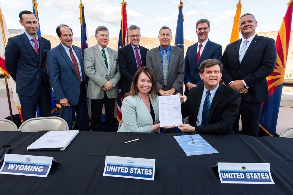
August 22nd, 2026: Interior signs final plan and Record of Decision

Overview

Updated Aug 23

Farmers and cities across the Southwest just learned how much less river water they will get. On August 22, the US Department of the Interior signed rules cutting Arizona, California and Nevada by about 1.25 million acre-feet a year, roughly 21% of their Colorado River supply. Arizona takes the deepest cut.

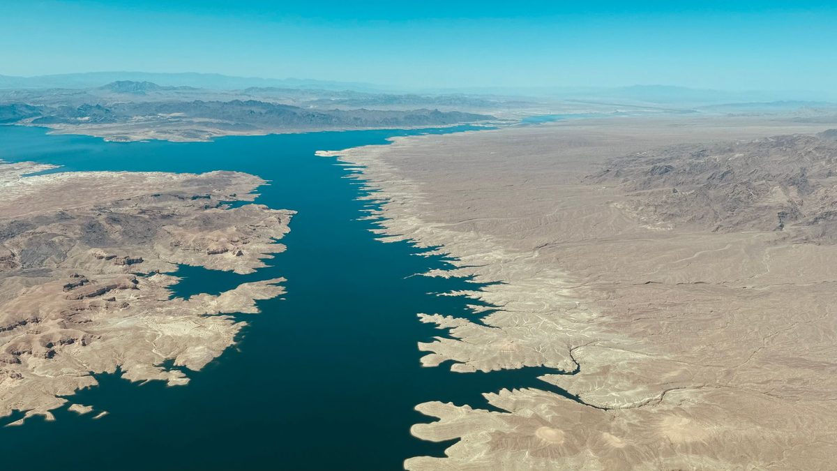
The river feeds about 40 million people. Its two biggest reservoirs, Lake Mead and Lake Powell, have dropped to near record lows. Seven states spent three years failing to agree on who should give up water, so the federal government wrote the rules itself. They take effect October 1.

Why it matters

Cities and farms from Phoenix to Southern California must now run on less river water, and future cuts could nearly double if the reservoirs keep falling.

Questions about this story

Free account needed to ask — your question is kept and asked for you right after sign-up. Answers are public.

No questions yet — be the first to ask.

Key Indicators

21%
Lower Basin cut
Share of Colorado River supply Arizona, California and Nevada lose starting in 2027.
1.25M acre-feet
Annual water reduction
Combined yearly cut for the three Lower Basin states.
760K acre-feet
Arizona's cut
Arizona absorbs the largest reduction because its river rights are among the most junior.
440K acre-feet
California's cut
A roughly 10% reduction, the smallest of the three states, reflecting its more senior water rights.
50K acre-feet
Nevada's cut
A roughly 16% reduction, the smallest volume but a sizable share of the state's total allocation.
40M
People served
Residents across seven states and Mexico who depend on the river.
~1,041 ft
Lake Mead elevation
Near the record low of 1,040.58 feet set in July 2022.

Voices

Curated perspectives — historical figures and your fellow readers.

Ever wondered what historical figures would say about today's headlines?

Sign up to generate historical perspectives on this story.

People Involved

Organizations Involved

Timeline

November 1922 August 2026

7 events Latest: August 22nd, 2026 · 3 weeks ago
Tap a bar to jump to that date
  1. Interior signs final plan and Record of Decision

    Latest Rule Change

    Secretary Burgum makes the cuts binding, setting 2027-2028 rules and a 10-year framework through 2036. New operations begin October 1.

  2. Lake Mead and Lake Powell hit record lows

    Milestone

    Combined storage falls below any level seen since before Lake Powell began filling in the early 1960s.

  3. Federal plan released for public review

    Proposal

    Interior proposes concentrating cuts on the three Lower Basin states, drawing reactions from 'encouraged' to 'draconian.'

  4. First federal shortage declared

    Rule Change

    The government declares the river's first official shortage, triggering mandatory 2022 cuts for Arizona and Nevada.

  5. Drought Contingency Plan signed

    Agreement

    States agree to voluntary extra reductions to slow the reservoirs' decline as drought deepens across the basin.

  6. Interior adopts interim shortage guidelines

    Rule Change

    The states agree to tiered cuts tied to Lake Mead's level, mostly hitting Arizona and Nevada first. These rules expire at the end of 2026.

  7. States sign the Colorado River Compact

    Agreement

    Seven states split the river between an Upper and Lower Basin, each promised 7.5 million acre-feet a year. The flow estimates came from unusually wet years.

Scenarios

1

Seven states sign a durable long-term deal

Possible Resolves by End of 2028

Discussed by: Tom Buschatzke and JB Hamby, who both call the current rules temporary

The 2027-2028 rules buy time. Negotiators from all seven states use it to agree on how to share shortages after 2028, including whether the Upper Basin accepts mandatory cuts. A consensus deal would replace federal imposition with a signed agreement, the pattern that produced the 2007 and 2019 arrangements.

2

Cuts deepen as reservoirs keep dropping

Possible Resolves by End of 2031

Discussed by: Reuters and CNN, citing Interior's warning that reductions could nearly double

Snowpack stays thin and the reservoirs keep falling. Under the 10-year framework, Reclamation moves into a lower operating tier and orders reductions larger than 1.25 million acre-feet a year. The three Lower Basin states, and possibly others, face cuts steeper than those set for 2027-2028.

3

A basin state sues over the plan

Possible Resolves by End of 2027

Discussed by: Arizona and California officials warning the burden is uneven between basins

The dispute over the Upper Basin's refusal to accept mandatory cuts hardens into litigation. A Lower Basin state, or a water district within one, files suit challenging the plan or seeking to compel upstream reductions. Such a case would test the Compact and could push the fight to federal court or the Supreme Court.

4

Wet winters ease the cuts early

Unlikely Resolves by Jan 1, 2029

Discussed by: Hydrologists cited by CNN noting the reservoirs' sensitivity to snowpack

Two strong snow years refill the reservoirs faster than expected. Lake Mead and Lake Powell climb into a higher operating tier, and Reclamation relaxes the scheduled reductions before the 2027-2028 rules expire. The near-term crisis eases, though the long-term structural gap between supply and demand remains.

5

Gila River Indian Community sues the Bureau of Reclamation

Possible Resolves by End of 2026

Discussed by: Governor Stephen Roe Lewis, who says the tribe was not properly consulted before the plan was finalized

The Gila River Indian Community holds the largest single share of Central Arizona Project water and was not part of the seven-state talks. Lewis has said the tribe will challenge the operating guidelines 'in every forum available' if the final rules don't protect its rights. A suit from the Community, or another basin tribe, would add a legal front separate from any dispute between the states themselves.

Historical Context

3 moments from history that rhyme with this story — and how they unfolded.

November 1922

Colorado River Compact (1922)

Seven states divided the river at Lees Ferry, promising 7.5 million acre-feet a year to each basin. Negotiators relied on flow records from some of the wettest years ever measured, so they promised more water than the river reliably carries.

Then

The deal let the Southwest build dams, farms and cities on the assumption of abundant water.

Now

The over-allocation baked in a structural shortfall that every later drought has exposed.

Why this matters now

The 2026 cuts are the bill coming due on a river that was divided as if it held more water than it does.

May 2019

Drought Contingency Plan (2019)

Facing the threat of federal action, the seven states negotiated voluntary extra cuts to keep the reservoirs from crashing. They chose a shared deal over an imposed one, narrowly beating a federal deadline.

Then

The plan slowed the reservoirs' decline for a few years.

Now

It showed consensus was possible, a precedent this year's negotiators failed to repeat.

Why this matters now

In 2026 the states could not agree, so the outcome they avoided in 2019, federal imposition, is what they got.

August 2021

First federal shortage declaration (2021)

With Lake Mead at record lows, the government declared the river's first official shortage. Mandatory 2022 cuts hit Arizona hardest, reducing the Central Arizona Project supply to farms near Phoenix and Tucson.

Then

Arizona farmers fallowed fields as their junior water rights were cut first.

Now

It established that Washington would enforce cuts by reservoir level, not wait for a crisis vote.

Why this matters now

The 2026 plan extends the same logic, but on a much larger scale and across all three Lower Basin states.

Sources

(9)